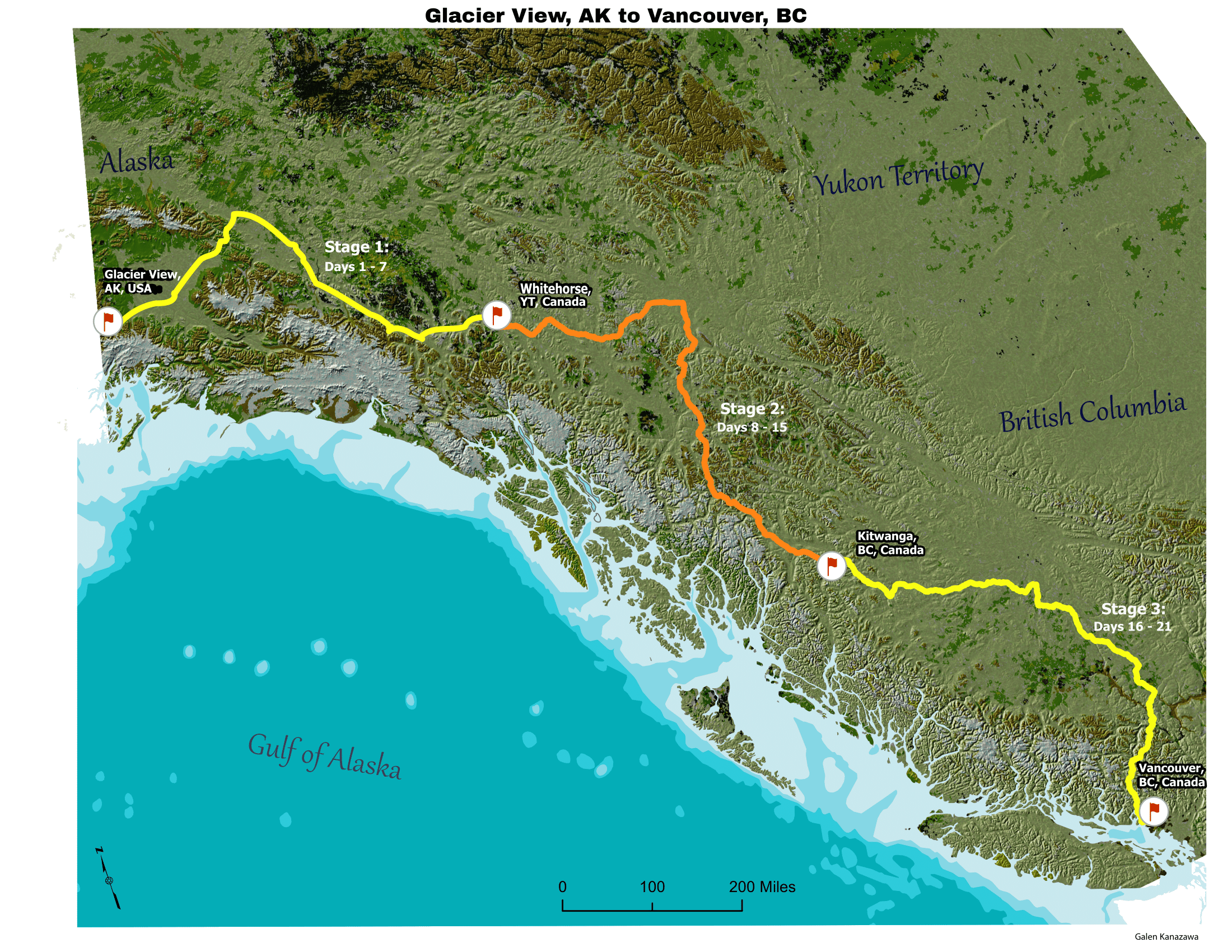
Shaded Relief Terrain Map
An academic terrain-mapping project for UW's Graphic Design in Cartography, this shaded-relief map portrays a hypothetical cycling race route running through British Columbia and part of southern Alaska. It was assembled in ArcGIS Pro from a land-cover layer, a digital elevation model, and two different Hillshades, then styled in Photoshop.